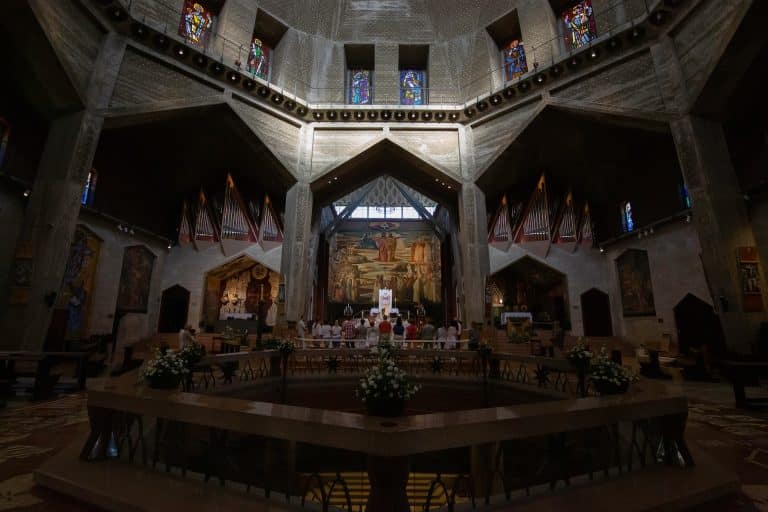
As a region with an abundance of tremendously important religious sites, the Galilee attracts millions of pilgrims every year, who are coming here to experience the incredible holiness of sites like Nazareth, Mount Tabor, the numerous sites around the Sea of Galilee, and more. While there are many different ways to tour the holy sites of Israel, one of the best ways to do so is on foot, by walking on the Jesus trail, an incredible multi-day trek that connects many of the holiest sites in the Galilee. Here is everything you should know about this epic pilgrimage.
The Jesus Trail: important things to know
The Jesus Trail is one of Israel’s longest hiking routes and is a pilgrimage that links holy Christian sites with a major significance in the story of Jesus’ life. The length of the path is about 65 km/40 miles, and it’s usually hiked in 4 days. This hike is relatively easy, as it mostly goes through paved and flat terrain.
The trail was marked on the occasion of the Pope’s visit to Israel in 2009 with white-orange-white trail markings. The path starts in the heart of the old city of Nazareth and ends in Capernaum, on the northern shores of the Sea of Galilee.
On its way, the trail passes through many historical places such as Zippori, Kfar Cana, Horns of Hattin, Mount Arbel, Mount of Beatitudes, and many more.
Trail logistics
The trail mostly goes through residential areas, as it passes by many small villages along the way. Thus, it is very easy to stock up on food and fill up water on your way. In addition, most travelers stay in the different accommodation options along the way, as camping along the entire Jesus trail is not particularly popular or convenient.
Jesus Trail: day by day
The Jesus Trail Section 1: From Nazareth to Kfar Cana via Zippori
Track length: about 16 km/10 miles.
The first day begins in the heart of the old city of Nazareth, near the well-known Fawzi Azar hostel. From here, we will continue with the marking of the white-orange-white path that will lead us through steep steps to the ridge that overlooks the city.
After enjoying the impressive view, we will continue and pass through the northern neighborhoods of the city of Nazareth, and leave the city. From here, the Jesus Trail continues for about 7 kilometers/4.3 miles on dirt roads, until it crosses road No. 79 and then reaches the Zippori Ridge and the entrance to the old town of Zippori.
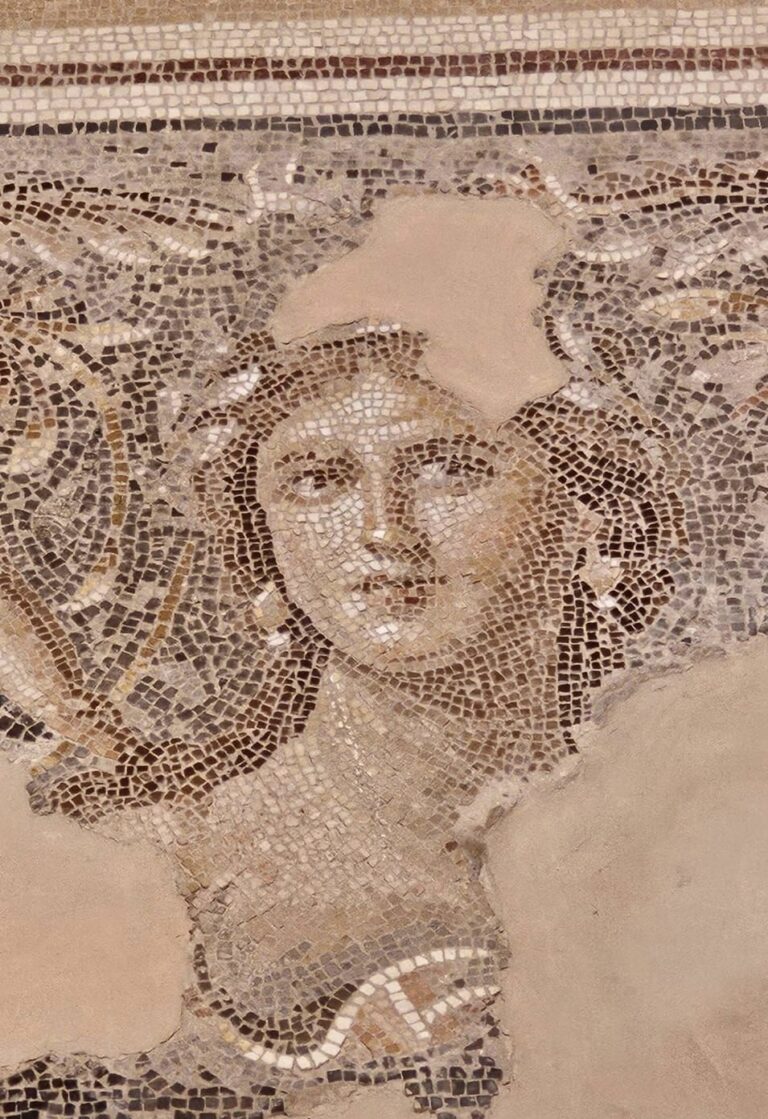
The path will lead us right to the grove next to the entrance to the Zippori National Park. To see the truly impressive part of Tzipori Antiquities, including the famous Mona Lisa of Galilee, you will have to enter the National Park. If time permits, it is definitely recommended to do so.
From here, the Jesus Trail continues parallel to the route of section 11 of the Israel National Trail, from Zippori to the town of Mashhad.
Mashhad is a small Arabic town with about ten thousand inhabitants. The meaning of the Arabic word “Mashhad” is a scene or observation, and it got its name because, according to tradition, this is the point from which Saladin watched the famous Battle of Hattin, where his Muslim forces defeated the Crusader army, and marked the beginning of the decline of the Crusader Empire’s rule in Israel.
A little more walking and we will reach Kfar Cana, the endpoint of the trail’s first section. Kfar Cana is important to Christianity mainly because of the Wedding Church, which commemorates the miracle at the wedding at Cana, where Jesus performed his first miracle, turning water into wine. The place where the miracle took place is commemorated in two nearby churches – the Franciscan Wedding Church and a Greek Orthodox Church.
Section 2: from Kfar Cana to Kibbutz Lavi
Track length: 14 km/8.7 miles.
We start the day when we finished the previous section of the Jesus Trail, leaving the village of Kfar Cana after visiting the Wedding Church.
From here we will set off, in what is probably the most beautiful part of the entire trail. We will climb the village to get out on the other side, and we will continue walking along the trail until we reach Moshav Ilaniya. The small village has a grocery store and an ecological farm where you can visit and even spend the night.
From here, we will continue to the Golani junction, where there is a gas station, a convenience store, and a variety of restaurants, making it a great stop on the way. This is the point where we have to cross Road 77, so pay close attention to the signage in the place pointing towards an underground passage that will bring you back above ground on the interchange, and from there lead you to the other side of the road through a wide white pedestrian bridge.
After the Golani junction, we will continue on a short, beautiful, and green section in the Lavi Forest until we reach Kibbutz Lavi, which is the endpoint of the second section. Inside Kibbutz Lavi or in the adjacent Givat Avni settlement there are B&Bs and overnight accommodations, while there is also a convenient overnight campground in the nearby Lavi forest.
Section 3: Kibbutz Lavi to Arbel
Track length: about 19 km/12 miles
Section 3 of the Jesus Trail begins at the entrance to Kibbutz Lavi. From this point the path continues and climbs up until at a certain point, on a day with good visibility, we can finally see the Sea of Galilee for the first time.
We will continue for about two kilometers/1.3 miles of comfortable walking, during which we will pass by the agricultural fields of the nearby Kibbutz Lavi until we reach an intersection. At the intersection, we will continue to the right to the path marked in black toward the ascent to the summit of the Horns of Hattin. From here we can see the two peaks that gave the beautiful mountain its name.
From Horns of Hattin, the path descends toward the village of Kfar Zeitim and passes near the Nabi Shu’ayb Tomb.
According to Druze tradition, this is the tomb of the prophet Shu’ayb, who is identified with the biblical figure Jethro. Every year, the site is used as a center for pilgrimage during the four-day Nabi Shu’ayb holiday, starting on April 24.
The path bypasses Kfar Zeitim to the west and connects to the route of Nahal Arbel. The walk in the stream is beautiful and reaches just below the settlement of Arbel, from where the path climbs up a steep but short ascent, at the end we will reach the entrance road to Arbel – the endpoint of the third section.
The Jesus Trail section 4: Arbel to Caper Nahum via the Mount of Beatitudes
Track length: about 20 km/12.5 miles.
We begin the last day of the Jesus Trail at the endpoint of the previous section, at the entrance to Arbel. We are already very close to the Sea of Galilee, but we will begin our day with an ascent to Mount Arbel, which rises to a height of about 390 meters/1,300 feet above the Sea of Galilee.
The climb is not easy, but it is not too long and with some rest and a slow pace it is also suitable for less fit travelers. On the top of the mountain, we can enjoy a magnificent view, as you can see the Galilee Mountains and the Golan Heights to the north, the Arbel Valley and Beit Netofa Valley to the west, and the Sea of Galilee and the southern Golan Heights to the east.
At the top of the mountain, the Jesus Trail joins the Israel National Trail again, and we will continue with it to a steep descent, which is partly made using steps carved in the rock and a few iron pegs, until reaching the Bedouin village of Wadi Hamam.
When we reach the foot of the mountain, we will continue with the road parallel to the village of Wadi Hamam until the intersection with road 807, where there is a gas station where you can stop for supplies and a light break.
We will continue along the marking of the Israel National Trail through banana plantations until we reach the town of Migdal.
From here, the path continues right on the shores of the Sea of Galilee until you reach Tabgha, Known for the Miracle of the Loaves and the Fishes, in which Jesus was able to feed 5,000 people with five loaves of bread and two fish.
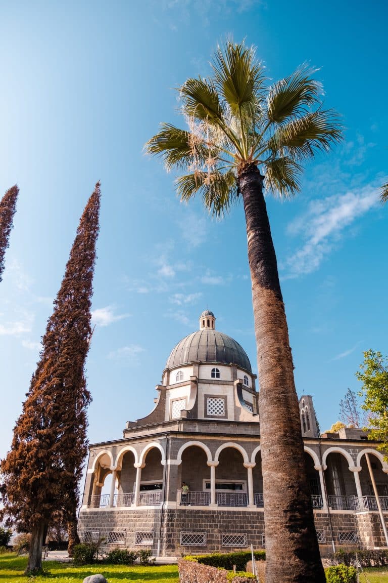
The path continues and passes by the Mount of Beatitudes, the place where Jesus delivered the Sermon on the Mount and chose the twelve apostles.
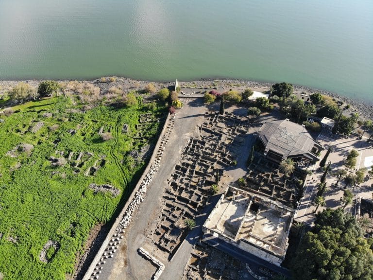
A little more walking and the path reaches Capernaum, the endpoint of the Jesus trail.