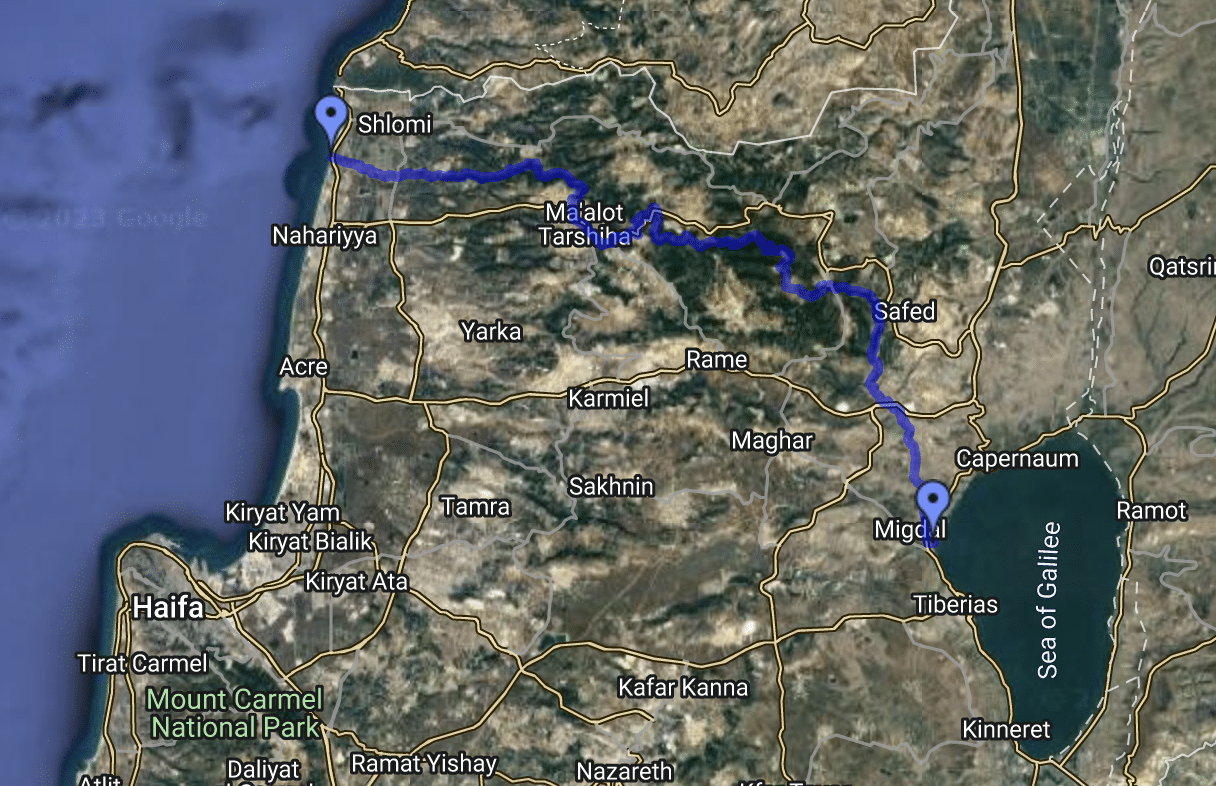
The Sea to Sea Trek, the most popular and impressive multi-day hike in the Galilee, is an epic 70-km/43.5-mile trail that goes through some of the most beautiful places in the Upper Galilee, including beautiful beaches, mountains, lakes, and rivers. As a comfortable trail with several accommodation options along the way, choosing to do the Sea to Sea trek during your trip to Israel will provide you with an epic experience to remember. Here is our guide for this wonderful trek, with everything you should know before embarking on your journey.
Sea to Sea Trek: important things to Know
Best time to do the trek
The best time to do the Sea to Sea trek is between autumn and spring, with the ideal time being late autumn or early spring. At this time, there are mild temperatures, as well as a relatively low chance of rain, which creates ideal hiking conditions. Without a doubt, the most beautiful time to hike here is the spring, when the Galilee is in full bloom, and you can enjoy nature at its finest. However, this region is beautiful at any time of the year, so it’s a great trek to do at other times as well.
When choosing the time of your hike, keep in mind that the trail may get very busy during holidays, such as Passover and Sukkot. When it comes to summer, while it’s technically possible to hike here at any time of the year, the Galilee can get very hot during summer, and many parts of the trail are very much exposed to the sun, so we would not recommend doing the full Sea to Sea Trek between June-September.
Accommodation options along the way
Most Israelis who do the Sea to Sea Trek stay in dedicated campgrounds along the way, usually in tents or sleeping bags. While it’s certainly a possible option for anyone, you should know that there are also great bed and breakfasts and even hotels, in towns along the way. In many cases, if you contact a bed and breakfast place in advance, they can also arrange to pick you up straight from the trail and drop you off there the next morning.
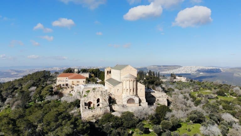
Some of the best places to stay during your trek include Abirim (after day 1), Mount Meron Field School, (after day 2), and Tzfat or Amirim (after day 3).
What to pack
Of course, you should bring all of the standard equipment for day hikes, like a hat, a sufficient amount of water, and good hiking shoes. In addition, we would highly recommend bringing a map of the area. Alternatively, you can download the Israeli app Amud Anan, which will show you the entire trek, and display your live location at all times.
Other than that, as this is a multi-day trek, it’s important to bring field cooking equipment and a sleeping bag, if you’re planning to sleep outside. In addition, as you will pass by several water sources along the way, we’d highly recommend you bring bathing suits.
When it comes to food, if you plan to cook by yourself, you can buy groceries in several towns along the way, so you don’t need to carry food for more than 2 days at a time, if you are willing to do some detours to nearby towns. Anyway, make sure you don’t count on buying food on a Saturday when almost all stores are closed.
How to get water in the trek
As a general rule for hiking in Israel, we would recommend carrying 4.5 liters of water per person per day. Along the Sea to Sea trek, you will find several places where you can fill up your water bottles for free, with at least one water-filling station per day. Those are mostly taps in different national parks and campgrounds, such as in Mount Meron. On the trail’s map, you can see signs of places to fill up water and plan accordingly.
Trail direction
It’s way more popular to hike the Sea to Sea trek from west to east. That is because the Sea of Galilee is lower than the mean sea level, so going in this direction means more descents than ascents.
Sea to Sea Trek: day by day guide
Day 1: Achziv – Abirim
It is usually customary to start the route from Achziv Beach, which is a little north of Nahariya, near the village of Gesher Haziv, which is right by Route 4. You can reach Nahariya by bus or train and from there take a bus to the beach, or get off at the Yad Leyad monument, which is the official starting point of the route.
From the starting point at the Yad Leid monument, we will continue with the path towards the settlement of Gesher Haziv towards the east and proceed along the dirt roads that cross fields and greenhouses until we reach an intersection before the settlement of Avdon. From the junction, we will turn right towards Ein Hardalit parking at the entrance to Nahal Kziv Nature Reserve.
We will pass by Ein Hardalit, which is a spring that originates in the Nahal Kziv reserve and is a popular attraction for many travelers during the hot summer days. This section of the route is very suitable for families given the proximity of the first wading pool to the parking lot and because it allows a very easy and fun walk through shallow water.
We will continue with the path and get to the foot of the impressive Monfort Fortress – a lovely ancient site that is a nice detour if you have enough time and energy to climb up and go back down the same way.
We will continue with the path and pass through several natural rocky pools, which are lovely for a short break if you want to cool down. The path will go and turn from a dirt road to a relatively narrow trail until we reach Ein Tamir, which can be a perfect point to stop and wade.
We will continue east from Ein Tamir for about three km/1.8 miles until we reach a fork in the road, where we will turn left to the path marked in black near the sign indicating the direction of Abirim. At this point, the path exits the river and continues uphill, on a relatively steep and challenging climb.
After completing the climb and exiting from the river, you will have two options: you can turn right towards the settlement of Abirim, where you can stay the night, whether it is in the Abirim campground or a B&B. Alternatively, you can continue with the path for another 5 km/3.1 miles towards the Elkosh Bridge – where there is another campground.
Day 2: Abirim to Mount Meron
If you stayed in Abirim, go back to the From the Abirim campground, we will continue and go down a light dirt road for about 300 meters/1,000 feet until we reach a farm gate, from where we will go to a path marked with a yellow trail marker that goes around Abirim. After about a kilometer of walking along the yellow-marked path, we will reach beautiful ruins, from where we’ll get stunning views of the Kziv River and Mount Meron.
From the ruin, the path continues east, bypasses Abirim from the east, and descends to Zavit River, where it connects to a green-marked path. From there, the trail continues winding along a dirt road to another ruin, and from there to Elkosh Bridge which rises above the Kziv stream, where there is another potential campground.
From here, we will continue descending with the path towards the east and back into the Kziv River, and we will pass by several small springs, among them the highlight of this part of the route: Ein Hotam – a spring that flows inside a cave that you can enter and swim in.
We will continue with the green-marked trail until an intersection with the red-marked trail. From here we have a decision to make: you can continue on the green path through Nahal Moran or continue with the path marked in red leading to a slightly shorter route that passes through Nahal Neria. Anyway, it’s not a high-stakes decision, as the two trails connect within a few kilometers to the route of the Israel National Trail, marked with white, blue, and orange, where we turn right (south) and continue with it until the end of the entire trek.
No matter which path you chose, at the intersection with the Israel National Trail, you will reach the Horvat Hamama campground where you can stay for the night. The campground is located near the Mount Meron Field School, which also offers accommodation options.
Day 3: Mount Meron to Amud River
A shorter day that goes up and down Mount Meron, the second-highest mountain in Israel, along the path of the Israel National Trail. The route starts along the path of the Mount Meron summit trail and passes by the summit campground (which includes water taps and is allowed for overnight stays). 3 kilometers/2 miles later we will reach the beautiful Ein Zeved, a wonderful place for a stopover.
From here the path descends more narrowly and steeply towards the east, and after about 1 km you have to turn right at a fork in the road. A descent of 1.5 km/1 mile leads to a mysterious structure made of huge stones, known as “Elijah’s Throne”, which is believed to be a kind of an ancient tomb.
Another short descent will bring us to the Ha-pitul campground located at the foot of the mount, a great place to spend your last night after the day’s tiring ascents and descents. This nice campground includes a water tap, and a short walk from the western end of the camp along a black-marked path will bring you to the grave of Rabbi Shimon Bar Yochai, one of the most important people in the history of Judaism.
Day 4: Amud River to the Sea of Galilee
From here the trail continues into the Amud River along the Israel National Trail. This is one of the most beautiful sections of the trail, as it goes all the way next to the flowing river, and offers many bathing options, along with tall trees that provide a pleasant environment and shaded parts. On the other hand, this section is one of the trail’s most challenging parts, as it includes many steep ascents and descents. So we would definitely recommend to start early, taking many breaks, and enjoying the natural pools along the way.
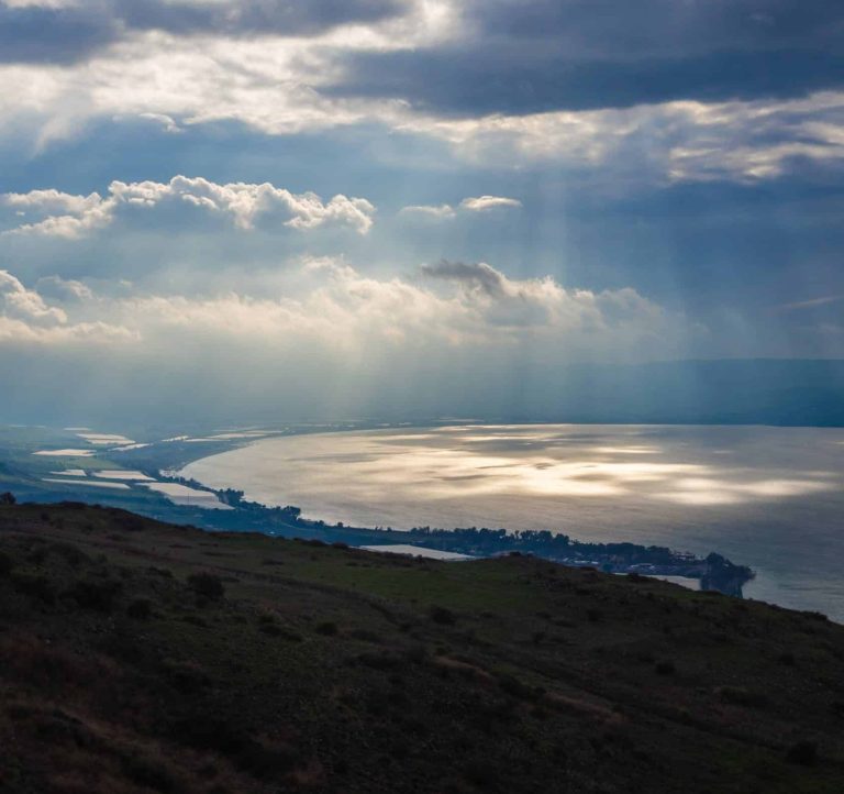
Close to the bottom of the stream, we will cross the access road to the village of Khukuk. From here, we will continue along a blue-marked dirt road that will bring us to the settlement of Ginosar, located right on the shores of the Sea of Galilee. From here, there isn’t a particular trail that goes to the lake, so just walk east, and find your way to one of the great beaches of the Sea of Galilee, where you can enjoy a well-desert swim and rest after a challenging trek.